Land south of Warmlake Road, Chart Sutton
Responding to Constraints
In drawing up our initial plans for the land south of Warmlake Road, we have studied the site and noted a number of constraints that our proposals need to take account of:
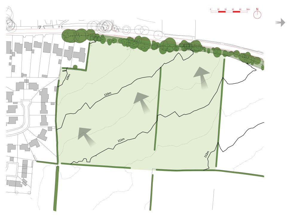
RESPONDING TO TOPOGRAPHY
The site is located on a gentle slope down
towards the north-west and Warmlake Road,
with a hillcrest in an adjacent field parcel to
the south-east. The proposed development
will respond to the existing topography in its
arrangement of access routes, drainage, and
building forms.
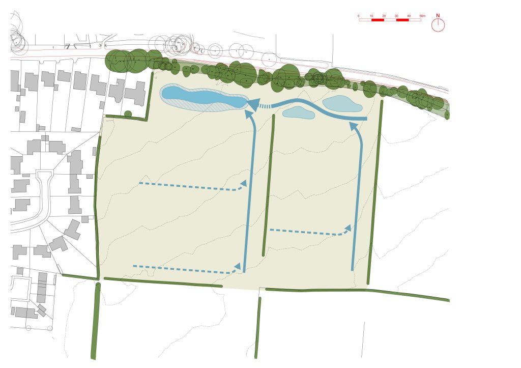
DRAINAGE
As seen in the topography, the site drains
towards the north-west corner, calling for a
network of attenuation basins and swales
along the northern boundary, which also
coincides with the proposed ecological buffer.
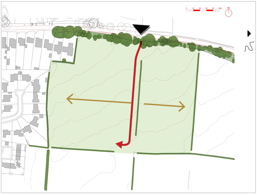
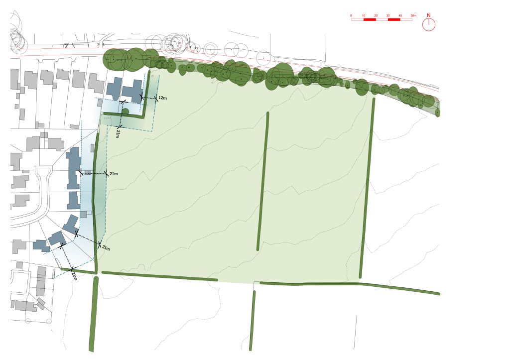
ACCESS
The presence of the windbreaker hedgerow
splits main access to the two field parcels
either side, with a weighting towards the
western parcel due to its comparatively larger
area and the alignment of the access point.
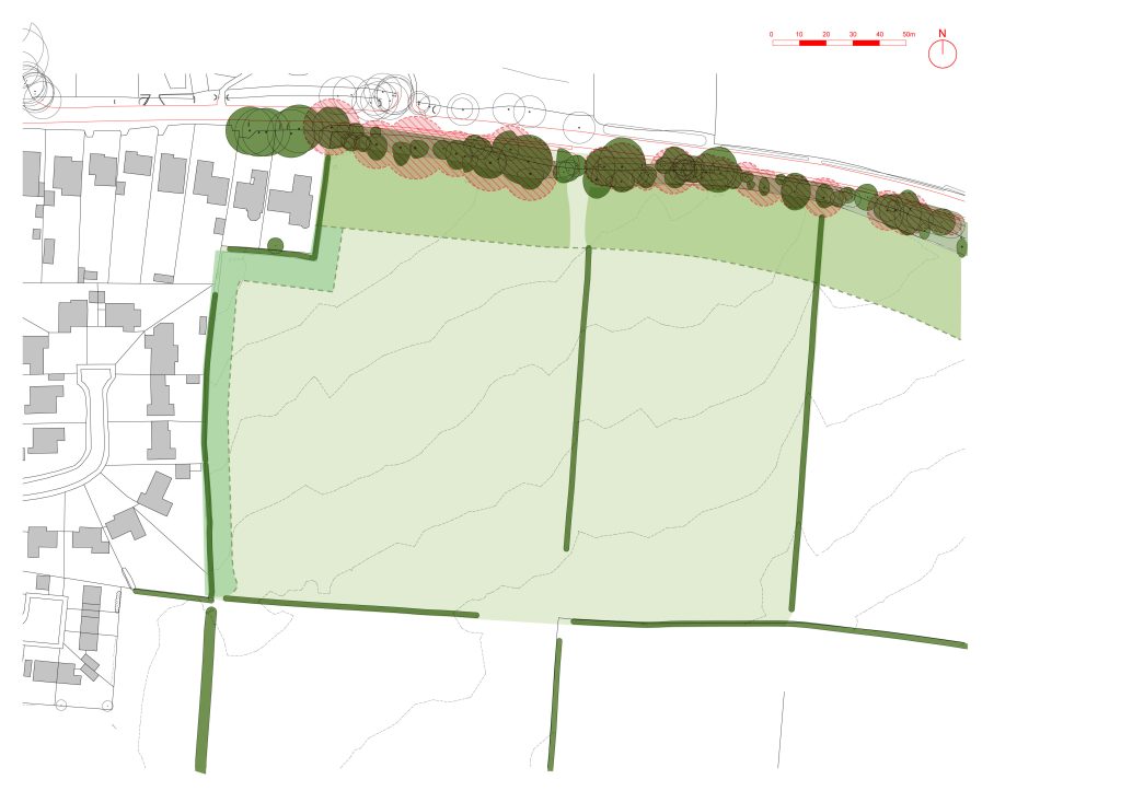
PROTECTING EXISTING HABITATS
Buffers are put into place to protect the
ecological value and integrity of the treebelt
to the northern boundary, as well as the
hedgerows to the west.
PRESERVING PRIVACY OF NEIGHBOURING HOMES
The development will respect privacy to
neighbouring homes by providing sufficient
distance from their elevations and garden
boundaries. Most of these are single-storey,
though consideration is given to views from
these homes where present.
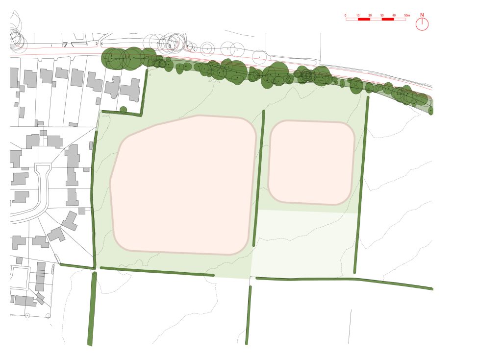
DEVELOPMENT SCALE
Taking the boundary buffers into
consideration, the two development parcels
are defined at a net density of 17.67 dwellings
per hectare. Existing developments around
Chart Sutton range between 10–30 dph.
Contact Us
If you have any queries, please contact Melisa Geshteja of SP Broadway on
07732 531570 or at melisa@spbroadway.com